Bird’s-Eye View
We’ve all played around with Google Earth, but did you know that seeing your home from a bird’s-eye view has been a possibility for nearly 90 years? The 1934 Aerial Survey, commissioned by Governor Wilbur Cross and the Connecticut State Planning Board, was the first government-sponsored statewide aerial survey. Camera-equipped airplanes from Fairchild Aerial Surveys crisscrossed the state during March and April of that year, capturing images of the land from 11,400 feet. The individual photographs were pieced together to form one large mosaic, which provided a snapshot of where every street, railroad, building, farm, forest, and body of water was located—valuable information for many governmental agencies planning for future development. Photos were also filed with the Connecticut State Library and made accessible to all.
The aerial survey was undertaken to help plan for the future. Still, it has become an indispensable resource for researchers and professionals in understanding the state’s shifting geography and land-use patterns.
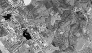
Storrs 1934
Fairchild Aerial Survey for the State Planning Board, aerial photo, April and May 1934. Connecticut State Library, State Archives Record Group 089:11a, Records of the Department of Transportation. Photograph courtesy of the Connecticut State Library
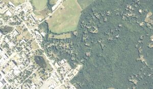
Storrs 2010
Photo Science, aerial photo, 2010. Photograph courtesy of the Connecticut Department of Energy and Environmental Protection
Compare the University of Connecticut’s Storrs campus in 1934 and 2010. New buildings have been added, and many trees have grown. Mirror Lake remains relatively unchanged.
Explore!
The aerial photographs can be accessed online thanks to the Connecticut State Library and the University of Connecticut Library Map and Geographic Information Center (MAGIC). Visit libguides.ctstatelibrary.org/hg/aerialphotos/.
On Our Coffee Table
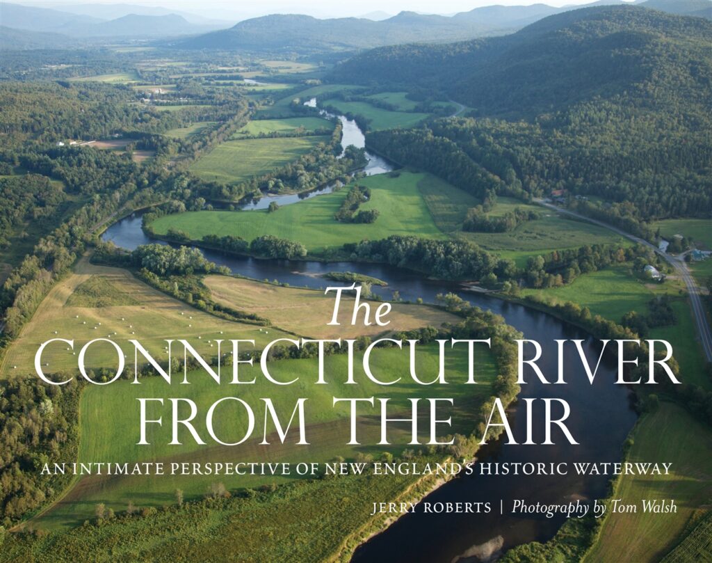 Jerry Roberts, The Connecticut River from the Air: An Intimate Perspective of New England’s Historic Waterway, photography by Tom Walsh (Globe Pequot, 2018)
When Jerry Roberts was executive director of the Connecticut River Museum in Essex, he teamed up with pilot and photographer Tom Walsh to capture aerial images of the entire length of the Connecticut River. The Connecticut River from the Air showcases remarkable photos interspersed with fascinating stories. This collection inspires awe at the river’s beauty and curiosity about how this natural feature has shaped human history.
Daredevil Flies Over Connecticut
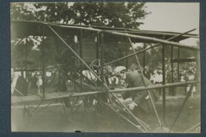 Hamilton prepares for his Aviation Day flight. Image: Hamilton Preparing His Flying Machine, 1911. The Connecticut Museum of Culture and History, Graphics Collection, 2000.194.12. Photograph courtesy of the Connecticut Museum of Culture and History
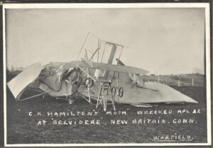 C.K. Hamilton’s Moth wrecked in the Belvidere neighborhood of New Britain, April 22, 1911. Photograph courtesy of the New Britain Industrial Museum
Pioneer aeronaut Charles K. Hamilton was born in New Britain in 1885. His 1910 round-trip journey from New York to Philadelphia marked the first flight between two major US cities. Later that year, a crowd of 50,000 witnessed him take flight at Walnut Hill Park, on his home city’s “Aviation Day.” This was the first reliably documented heavier-than-air flight in Connecticut.
Over the course of his career, Hamilton, known for his daring stunts, survived 60 crashes. When he returned to fly over New Britain again in 1911, he crashed but only sustained minor injuries. He ultimately died in 1914 at the age of 28 after a long bout of tuberculosis. He is buried in Hartford’s Cedar Hill Cemetery.
Connecticut Chronology
Put the letter corresponding to each event in the correct box on the timeline.
[needs timeline graphic with the dates listed and empty boxes for people to write in the matching letter]
1660 ▢ a. The Corsair made its first flight.
1833 ▢ b. The first fuel cell was designed.
1839 ▢ c. John Winthrop Jr. became the first person in America to look through a telescope.
1892 ▢ d. Apollo 11, powered by South Windsor fuel cells, carried a man to the moon.
1940 ▢ e. The Naugatuck Footwear Company was founded. This company would go on to produce barrage balloons during World War II.
1953 ▢ f. Elijah Hinsdale Burritt published The Geography of the Heavens, an astronomy textbook.
1969 ▢ g. The final Corsair was produced.
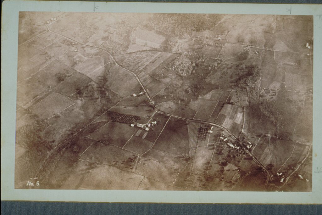 John G. Doughty, Bloomfield From a Balloon, View No. 5. The Connecticut Museum of Culture and History, Graphics Collection, 2000.194.7. Photograph courtesy of the Connecticut Museum of Culture and History
Bonus: Can you guess when John G. Doughty took this aerial photograph of Bloomfield from a hot air balloon? His were among the first photographs ever taken from a balloon.
- 1857
- 1885
- 1901

Answer Key Timeline: 1660, C; 1833, F; 1839, B; 1892, E; 1940, A; 1953, G; 1969; Bonus: B