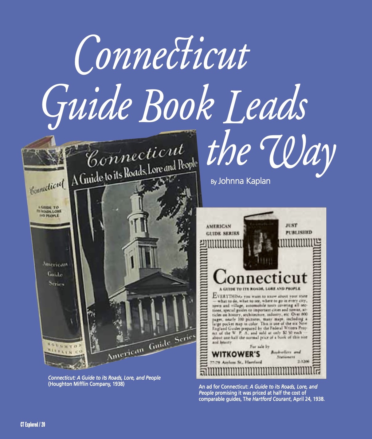
(left) “Connecticut: A Guide to its Roads, Lore, and People “(Houghton Mifflin Company, 1938), right: An ad for Connecticut: A Guide to its Roads, Lore, and People promising it was priced at half the cost of comparable guides, The Hartford Courant, April 24, 1938.
By Johnna Kaplan
(c) Connecticut Explored Inc., Summer 2021
Subscribe/Buy the Issue!
The traveler along the Boston Post Road, with its gasoline stations and wayside restaurants, gets but a few glimpses of charming coastal villages and sequestered inland hamlets set among the hills; but let him wander off the beaten paths and he will discover a countryside much as it was in the pre-Revolutionary days.
This sentence was written by one of many anonymous authors paid to travel the highways and backroads of Connecticut in the aftermath of the Great Depression. It was published in 1938, in Connecticut: A Guide to Its Roads, Lore, and People. The nearly 600-page guidebook was one of more than 100 state, territory, city, and regional guides produced by the Federal Writers’ Project (FWP) of the Works Progress Administration (WPA), one of the “alphabet soup” of agencies that made up the New Deal. If the Civilian Conservation Corps (CCC) helped America beautify itself with parks and forests, and the Federal Art Project (FAP) helped America see itself in brightly painted murals, then the FWP helped America find itself with thousands of pages of turn-by-turn directions.
Moreover, the guidebook’s predecessor, The Connecticut Guide: What to See and Where to Find It, published just three years before, was the inspiration for what would be called the American Guide Series. This was surprising, given that Connecticut had few examples before that. In the 18th century, Connecticut appeared in travel literature only incidentally, as in Sarah Kemble Knight’s account of her 1704 trip from Boston to New York. The journey on horseback, following an established postal route, took five months and was often perilous. Leaving New London for “Seabrook” (today’s Old Saybrook), Knight wrote that the “Rodes all along this way are very bad, Encumbered with Rocks and mountainous passages.” The bad road soon crossed a bridge, “under wch the River Run very swift, my hors stumbled, and very narrowly ‘scaped falling over into the water; wch extremely frightened mee.”
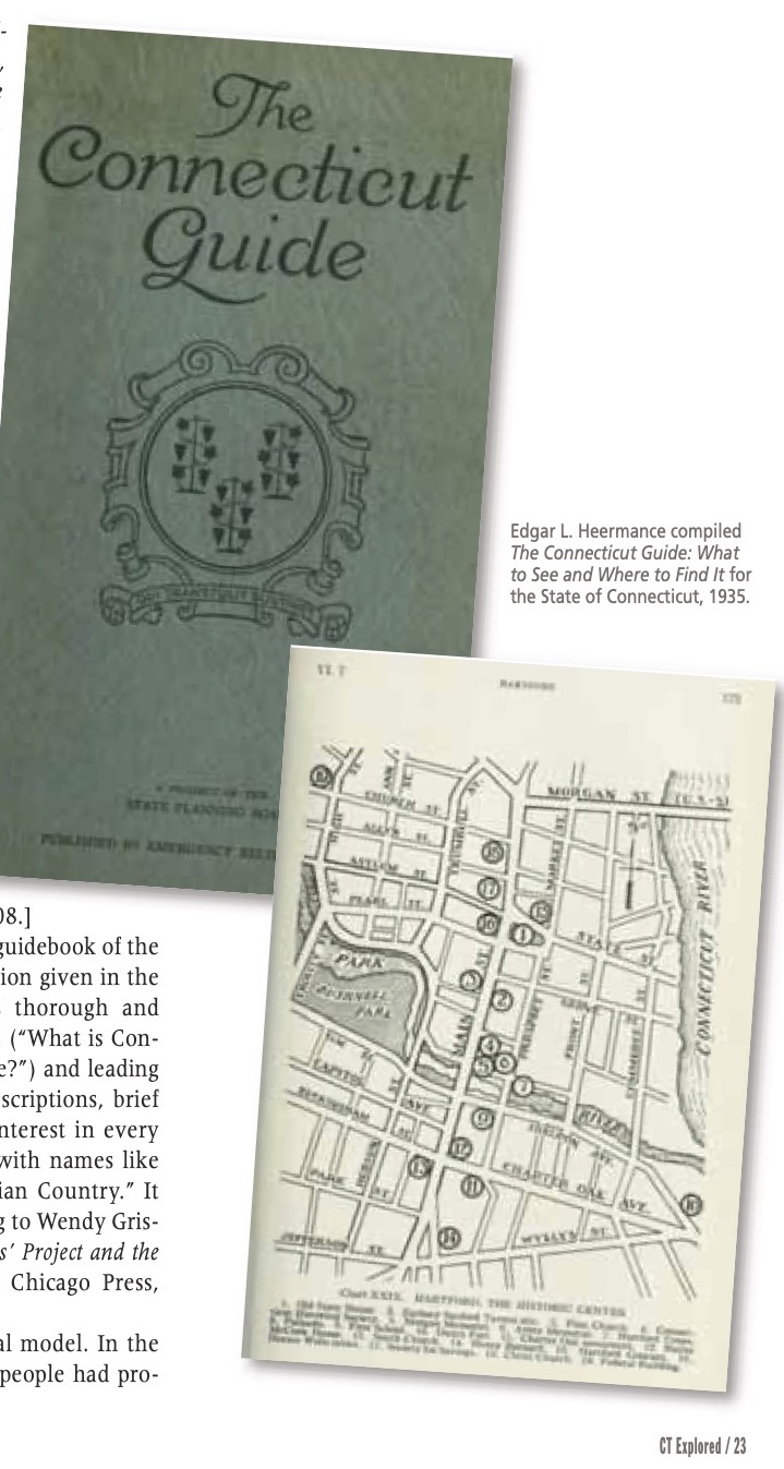
Edgar L. Heermance compiled The Connecticut Guide: What to See and Where to Find It for the State of Connecticut, 1935.
Guidance for travelers in the next century wasn’t much better. Even as European guidebooks proliferated, with Thomas Cook, John Murray, and Karl Baedeker (whose name would later become synonymous with the word guidebook) encouraging Grand Tour-inspired voyages across the continent, early 19th-century America produced only a few maps with route descriptions, written by surveyors, and a small handful of rudimentary city guides. The 1817 Picture of New-York, or the Stranger’s Guide to the Commercial Metropolis of the United States noted the gap in the market: “It seems rather singular that a city so extensive, so populous, and possessing so many institutions and attractions … should have been so long without a Guide to direct the Stranger.”
When the first real American tourist guides were published in quick succession in the 1820s, Richard Gassan asserts in “The First American Tourist Guidebooks: Authorship and the Print Culture of the 1820s” (Book History, Vol. 8, 2005),they all focused on New York State, particularly Saratoga Springs and Niagara Falls. One, The Northern Traveller, was written by Theodore Dwight, Connecticut native and nephew of Yale College president Timothy Dwight. Theodore Dwight also edited his late uncle’s letters into the four-volume Travels in New England and New York—a work that, despite its title, was not a guidebook.
Travelers in Connecticut could find some information about local destinations in history books such as John Warner Barber’s Connecticut Historical Collections, Containing a General Collection of Interesting Facts, Traditions, Biographical Sketches, Anecdotes, Etc., Relating to the History and Antiquities of Every Town in Connecticut with Geographical Descriptions. Published in 1836, this volume, often cited by later travel writers, combined popular history with Barber’s charming engravings.
John Warner Barber’s 1838 Historical Collections became a popular source of information for tourists about Connecticut. It is cited as an inspiration in the FWP’s guide.
In the early 20th century American travel underwent a massive shift, as Clara Walker Whiteside’s 1926 Touring New England on the Trail of the Yankee evokes. She wrote of a madcap road trip with a travel companion in a spontaneously purchased car, searching for a performance of P.T. Barnum’s circus in Bridgeport, forgetting to put gas in their car in Ridgefield, having trouble finding a place to park in New London, and tracking down, anthropologist-style, tales from local old-timers everywhere.
Despite her passion for history and scenic views, however, Whiteside made clear that her narrative was “in no sense intended to be used as a guide-book.” Her description of New London’s roads, which she found almost as harrowing as Knight had, though for different reasons, was not written to aid her fellow travelers: “We had as much of the road as was necessary mapped out in our head,” she wrote, and “Blue Books … have a way of getting mislaid just before you come to cross-roads.”
Whiteside was referring to the Official Automobile Blue Book, first published in 1901 by Charles Howard Gillette of Hartford, which geographer John T. Bauer, in an article in Cartographic Perspectives (Winter 2009), called the precursor to the American road map. Gillette, a businessman, founded the Automobile Club of Hartford in 1902 and was secretary of the American Automobile Association (AAA). His guides, which included points of interest, hotel and gas station listings, and precise directions for thousands of driving routes, helped the growing number of American motorists navigate this modern mode of travel.
It wasn’t long before the Blue Book had competition from other publishers. The advent of the Ford Model T in 1908 made automobiles accessible to a broader swath of the public. In the next few decades, as middle-class car ownership grew and highways were improved nationwide, traveling by road (as opposed to rail or steamship) grew in popularity. The first AAA road map was printed in 1905; the following year the group established a bureau of touring information to provide members more detail about routes and hotels.
In 1924 Rand McNally published Auto Chum, the first edition of what would become the company’s ubiquitous road atlas. Beginning in 1936 African American travelers had The Negro Motorist Green Book, which listed places Black tourists could visit safely. [See “Connecticut’s Green Book Sites,” Spring 2020.] Written by New York postal worker Victor Hugo Green, the books were modeled after earlier guides offering similar advice for Jewish-American travelers. From the mainstream to the niche, these guidebooks and maps helped Americans explore the nation, which they divided into large swaths.
But to find routes within Connecticut, a traveler would need the Blue Book covering New England and Eastern Canada. A few Connecticans attempted to fill this void. In 1923 the Mattatuck Historical Society of Waterbury published the 80-page Tourist’s Guide to Connecticut: Containing Lists of Old and Historical Houses, Historical Sites and Other Things of Interest in the State. An announcement of the publication in House Beautiful that year began, “Most tourists in New England have, as a rule, neglected Connecticut.” The pamphlet lacked travel information but provided town-by-town listings of antiques dealers and miscellaneous historical facts.
In 1935, in the midst of the Great Depression, Edgar L. Heermance compiled The Connecticut Guide: What to See and Where to Find It for the State of Connecticut. Begun as a survey of historic places for the Civil Works Administration of Connecticut in honor of the state’s tercentenary, the book was funded by the Federal Emergency Relief Administration (FERA). Its production involved about a thousand people, including, as it noted, “various specialists” and “a keen and enthusiastic field crew, who covered every town through interviews and personal exploration.” The effort was led by Heermance, who is remembered as the secretary of the Connecticut Forest & Park Association and father of the Blue-Blazed Hiking Trail system. [See “Connecticut’s Historic Trails,” Summer 2008.]
The Connecticut Guide was intended as “a guidebook of the Baedeker type, to supplement the information given in the annual automobile touring books.” It is thorough and earnest, starting with a sort of FAQ section (“What is Connecticut?” “What of the Connecticut Village?”) and leading visitors through the state with general descriptions, brief local histories, and directions to sites of interest in every town. It is organized into 14 “Journeys” with names like “Through the Brass Towns” and “The Indian Country.” It sold 10,000 copies in two months, according to Wendy Griswold in American Guides: The Federal Writers’ Project and the Casting of American Culture (University of Chicago Press, 2016).
The Connecticut Guide became a national model. In the early years of the New Deal, a number of people had proposed putting writers to work on guidebooks, including a Michigan FERA supervisor who suggested “a sort of public Baedeker” for each state (Katherine Kellock was another proponent of the idea.) Heermance’s The Connecticut Guide gave Henry Alsberg, director of the FWP, a blueprint for the American Guide Series. As the federal government’s 1947 Final Report on the WPA Program put it, “a plan of having them produce a guide book was tried out in Connecticut. The Connecticut guidebook proved so successful that the plan was expanded to national proportions by the WPA.”
The FWP’s Connecticut: A Guide to Its Roads, Lore, and People, took Heermance’s book (and, with his permission, his files full of notes) and expanded it. If not as long as the FWP’s guide for Washington, D.C., about which President Roosevelt joked that it should come with its own steamer trunk, Connecticut went deeper, including a history, a current portrait of the state and its people, and an overview of mileposts and monuments. Written for both travelers and readers, it styled itself as a “practical travel book” and a “valuable reference work,” that was at turns folksy, quirky, and funny, without losing the erudition of its predecessor.
Different writers worked on different sections, and essays might be contributed by outside experts. Connecticut credits public librarians, Yale and Wesleyan professors, local historians, and esteemed specialists on subjects such as ornithology and railroads. Overviews of topics like Connecticut’s history, government, and geology deftly summarize the basics. Other sections are illuminating reflections of their era. The essay on the state’s racial makeup discusses English, Irish, German, Canadian, Scandinavian, Italian, Polish, Slavic, Jewish, and “Negro” populations, among others. “The Indians of Connecticut” get their own section, as was standard in the series.
Essays about manufacturing, shipping, fisheries, and mining describe the state’s economy from colonial times to the time of publication. Though informative, these sections are never dull; the essay called “Natural Resources and Conservation” notes, “Portland brownstone went out of fashion shortly after the last dust-ruffle brushed the sidewalk.” Facts, practical or otherwise, are interspersed throughout. (“Only one of the state’s 169 towns (Union) is without electrical service.” “Recently, the persimmon has been grown as far north as Rockville.”)
The “Calendar of Annual Events” lists agricultural fairs and various ethnic celebrations, such as a Ukrainian Festival in New Britain featuring “folk dances presented in native costumes.” Sections on forests, waterways, transportation, plants, and animals are primarily primers for general readers, though they occasionally dispense travel advice; for instance, “The only strictly commercial airport is Rentschler Field at East Hartford” and “Skunks never invite trouble and only their curiosity and independence cause them to be ranked as undesirable. It is advisable to give the skunk more than half the road.”
The bulk of the guide consists of the travel sections. The first, titled “Main Street and Village Green,” features tours of 24 larger cities and towns, and comes complete with city maps. The second, “High Roads and Low Roads,” consists of 10 driving tours, each branching off into numerous detours, all with highly detailed directions.
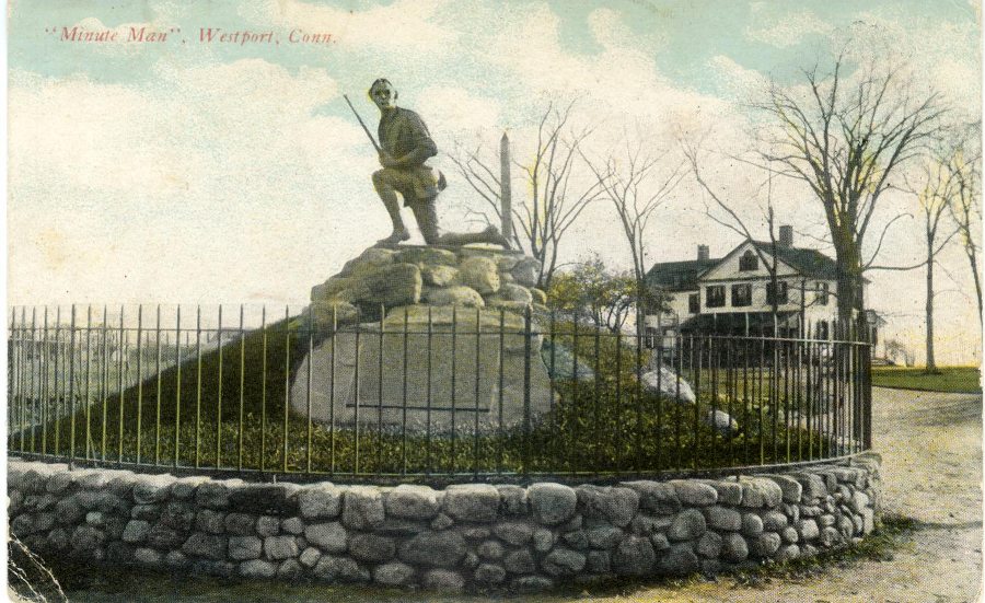
Postcard, The Minute Man monument, Westport, 1912.
To read the travel portion of the guide today, and especially to attempt to follow it, is both fun and frustrating. One occasionally wonders whether the FWP’s often young, often inexperienced travel writers simply got confused. For example, Tour 1A, from Darien to Fairfield, places Westport’s Minuteman statue at the junction of Route 136 and Compo Road. In fact, the statue is located about a mile from there, at Compo Road South and Compo Beach Road. At times, the guide’s directions can be indecipherable. From the incorrectly placed Minuteman statue, for example, the driver is directed to take a side road and rejoin Route 136 as it leads along the coast to Southport. Route 136 today goes north to Easton; however, the route described (today’s Hillspoint and Greens Farms roads) was designated as Route 136 between 1932 and 1963.
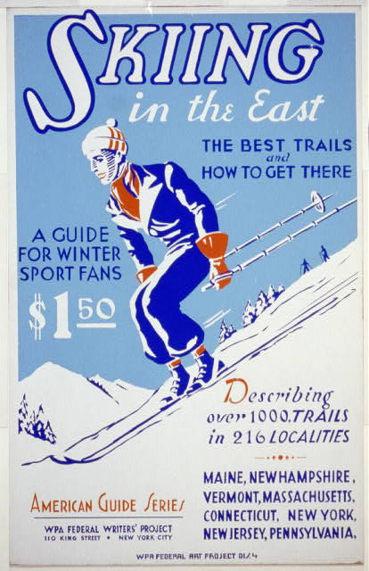
The FWP produced regional guides, such
as Skiing in the East: the Best Trails and How to Get There, 1936. The Connecticut section is short; its introduction states, “There is little of the Tyrol to be found in Connecticut.” Library of Congress
Across the country, the FWP employed roughly 6,500 people (an unknown number of them in Connecticut), a fraction of the 8 million jobs created by the WPA overall. Its goal was not to produce great literature, but simply to provide emergency relief to people who were out of work. Just 10 percent of FWP workers could be drawn from a pool of working writers; the rest had to demonstrate dire poverty to be hired. They came from all walks of life, and many had not written professionally before. They were a diverse group, including women and members of ethnic minorities. They eventually completed not just the travel guides but hundreds of other publications, including records of local folklore and oral histories of formerly enslaved people. A few were prominent authors; others, such as Zora Neale Hurston, John Cheever, Studs Terkel, Richard Wright, and Saul Bellow, would go on to literary stardom. But the vast majority were uncredited and remain unknown.
All of the American Guides were released by 1941. Published by commercial publishers (Connecticut’s by Houghton Mifflin), they were widely promoted by the WPA and largely praised in the press. The Hartford Times described Connecticut as “distinguished.” Lewis Mumford wrote in The New Republic that the guidebooks were “the finest contribution to American patriotism that has been made in our generation.” They were purchased by school and public libraries, sent to Book of the Month Club members, and sold in bookstores.
The FWP American Guide Series also had a profound impact on the genre. Earlier guides had not split the nation cleanly into states, nor had they so strongly emphasized each state’s distinct qualities. These innovations, along with the FWP guides’ blend of readable background essays and practical information, are now expected of any American guidebook.
When Connecticut: A Guide to its Roads, Lore, and People was written, there was no Bradley International Airport, no I-95 or I-84, and no Dunkin’ Donuts. Since its publication, roads have been rerouted, industries have declined or sprung up, and storms have altered the landscape. Yet the FWP guide feels less ephemeral than many guidebooks that have been published since. Rather than reading like a relic retrieved from a time capsule, it captures something essential about the character of Connecticut and the experience of traveling in it. It can still, as Governor Wilbur Cross wrote in the guide’s foreword, “help its readers not only to find their way through valleys and over hills, but to understand what lies back of all they see.”
Johnna Kaplan is a freelance writer. She blogs at thesizeofconnecticut.com. She last wrote “Stewart B. McKinney Wildlife Refuge,” Spring 2021.
GO TO NEXT STORY
Go back to Summer 2021 Contents
To your mailbox: Subscribe/Buy the Print Issue
To your inbox: Sign up for our bi-weekly e-newsletter